
An overall view of the mountain ranges around Tucson. To the West are the Tucson mountains (which I hiked with Terra. They're relatively small, maybe 4500 feet high (Tucson is 2800).
To the South are the Santa Ritas. They're pretty far away -- the others nestle up next to Tucson, but those are about 30 miles down the road. The U of A has a 6.5 meter and several other telescopes on Mt. Hopkins in the Santa Ritas. I did a day hike in the Santa Ritas with Brian Monroe in October of 1999.
To the North, and most easily visible from my front porch are the Santa Catalina Mountains, referred to locally as 'Mount Lemmon' ususally. Xander and I have been on two hikes up here, both of which I just made the official webpage for now since I was thinking of it . . . We hiked to Mount Kimball and across the Santa Catalina mountain range.

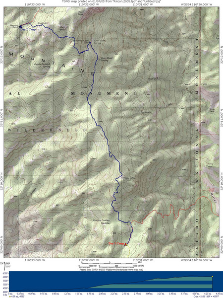
The proposed hike is in the Rincon mountains, east of town. This would complete my quadrifecta of hikes in the local mountain ranges. The Rincons are pretty high (we'll max out at 8664 ft), so it will be a lot cooler up there than down at the bottom. I've been on this road east of the Rincons several times, once with Dad, Grandpa, Dave Hawks, and his local friend to look for insects, and another time for The Little Rincons Rogaine.

We'll drive around to the East side of the Rincons to start. The first day we hike up 2000 feet in 4.5 miles to our first campsite. From there we can optionally drop our packs and climb up to the top of Rincon Peak, another 2000 feet to 8482' over 3-4 miles. The peak-scalers then hike back down to the campsite.
Day 2 calls for a hike Northward along the ridge toward Mica mountain, the tallest peak in the Rincons and also the tallest in Saguaro National Park. The elevation profile at the bottom of this picture is wrong. This day is mostly flat, and we'll camp below Mica mountain, scaling it (optionally) (only another few 100 feet) either in the evening or the morning.
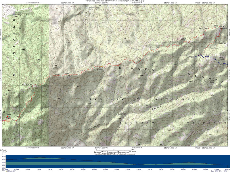
On day 3 we turn West, hiking along the main spine of the the Rincons toward my house. The slopes should be rather gentle, as we're going along a ridge. We go down about 2000 feet and then up just a couple 100 to hit Tanque Verde Peak before dropping a few hundred feet into camp for the night.

The last day is pretty easy, 6 miles down to the trailhead at the National Park where we call Gwen to pick us up, hopefully in the early afternoon.